Adventure: Polygonising Massive Geographic areas (with ease)
I have been busy lately making tools to better manage large regions,specifically concentrating on the generation of polygons for massive, and large numbers of geographical regions.
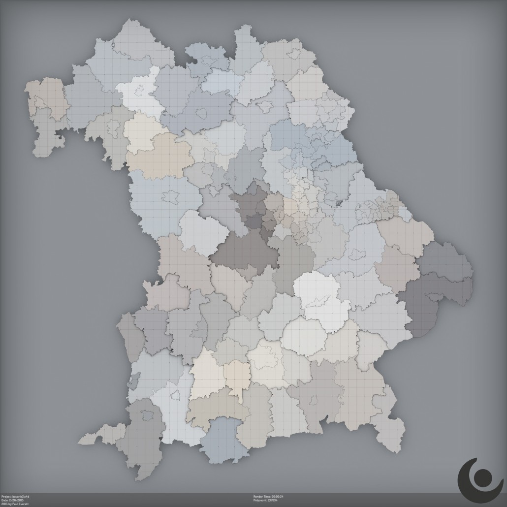
The scene shown, represents all the major counties of Bavaria, Germany, and a lot of smaller districts. This is just 549 objects, and 217k polygons.
The objects, and geometry where built using a new, custom loader plugin, and DEM Earth. The loader imports, an unlimited number of borders, with shocking ease, and sets them up perfectly for C4D for optimal, fast and flexible usage. I used mograph to juggle them up a bit, and the shading is done via my Ninja color shader. These scenes could be made to work perfectly well, with any application, with just a few clicks.
This Bavaria scene, is a very small example of what I can now achieve in C4D with minimal effort. It is now possible to polygonize the borders of every village,town,county,state or continent on this planet. Either a single district, or an entire continent. This is quite unique, and very powerful. IMO, there is no other tool in existence that can do what this does, with this of ease of use.
- I am thinking very about what to do with this :)
Paul


It would be great to have this feature in DEM Earth! :) Just started with your plugin and I’m very impressed…