


DEM Earth
Easily Generate dynamic Digital Elevation Models and georeference them in real-time to your world imagery.
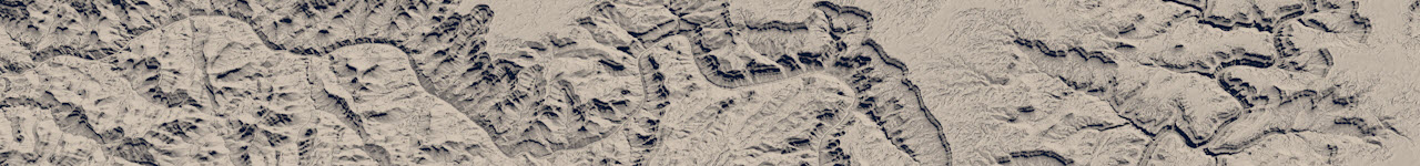
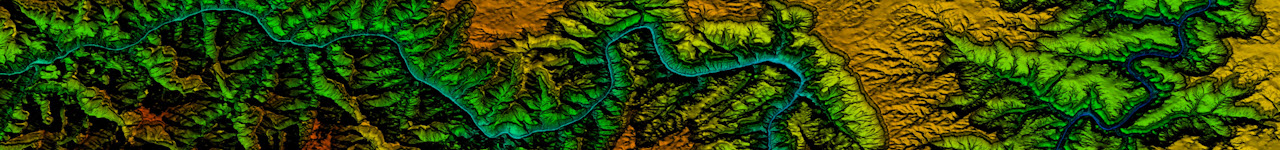
DEM Earth automatically downloads the data it needs to build the model you want. All you have to do is provide a Geographic coordinate.
Produce real-time interactive and dynamic landscapes which you can pan, zoom and animate and place anything on, in any way you want.
What you get
- DEM Earth Generator – A realtime landscape generator which automatically downloads and caches DEM data for you, for the entire world.
- Geo-Coding Tool – included. Both coding and inverse coding to get get coordinates from names, and names from coordinates.
- Data Manger – Manager custom layers and select height data from the Data Manager.
- Smart OSM Object – Easily download and manage OpenStreetMap data directly in DEM Earth. More..
- Smart Extruder Object – A fast, intelligent building extruder, which works tightly with OSM Object and DEM Earth to produce great results. More..
- Poly Object : Openstreetmap Administrative borders for the entire planet. Hundreds of thousands of Polygon borders and outlines, at your fingertips with this incredibly easy to use and very powerful feature. For R20 or greater.. More Info.. and this..
- PinPoint Object – Used for placing any 3D object on DEM Earth landscape with ability to dynamically scale and move with the landscape
- Route Object – Calculate routes with this powerful and flexible spline generator. Ideal for Visualizing routes and paths between points and places. More info..
- Geo Modifier – easily overlay anything DEM Earth onto DEM Earth. Now includes fields support.
- GPX Importer – Easily import Tracks, Routes and Waypoints. via the Poly Object.
- World File Import – drag and drop industry standard World files into C4D and DEM Earth will create the landscape for you and overlay your image automatically
- ASC height Import – Embed super high res height, commercial DEM or DSM data, directly into DEM Earth, using industry standard ASC format (*Esri Grid, WGS84 geographic )
- Direct ASC import – included. The only way there is, to get a super accurate, non-interpolated, high res landscape data into Cinema4D. This is how easy importing DEM data should be.
- 7 different DEM data sets from 30m to 90m– Automatically download height data, in realtime, as you work.
- DEM Earth Image Downloader – Included. Easily capture web-based images from a multitude of open sources, with unparalleled ease. Access up to 22 different image map layers, or use your own imagery, or shaders.
- Infinity Object. The solution for large areas, when you need to see everything..
- Cloner – Drop your trees in the right place.. Use the world tree mask to help place your trees.
New stuff.
- Outliner Generator- Easily Polygonise splines.. using the insanely fast DEM Earth Outliner. Faster and more flexible than letting a render engine do it. Works with all render engines.
- Structure Generator– Create Villages or sci-fi cities with this.. crazy easy use block generator.
- Trim spline Modifier -Crazy fast spline Trimer, for huge spline and segment counts. The only solution there is for Trimming entire cities, at blistering speeds.
- Cluster Spline Generator – Rearranges Spline Segments.
- Geo Edge Modifier – Hide edges and more.
- CSV import – Load places via the Poly object, using a csv file.
WIP open beta’s
- Fragment Object – Smart object Fragmentation. More info..
- Delta Erosion. an Erosion object, for DEM Earth. More info…
Optional World Ocean masking is available on demand. More Info..

Buy
Renew Your Support
Upgrade
Current version
- WIN v5.564 for Cinema 4D R20 to 2025
- Mac v5.200 for C4D 2023 and 2024
Compatibility
- All versions accept Cineware.
- C4dLite (Cineware) is NOT supported..
- Supports all render engines.
- 64 bit only.
License
- Node locked or optional Floating license (with R5.xx in R20 and beyond)
Requirements
- An Internet connection.
- At least 10 GB ram. (more recommended)
- A decent graphics card.
- A 64bit OS


